 Scoop has an Ethical Paywall


Expedition to measure world’s largest current
Media Release Tuesday 6 March
2007
Expedition to measure world’s largest
current
A trans-Tasman team of scientists is setting out to discover just how much water flows south of New Zealand as part of the world’s largest current, the Antarctic Circumpolar Current.
‘It’s been estimated that this current is 110–150 times larger than all the water flowing in all the rivers of the world,’ says voyage leader Dr Mike Williams of the National Institute of Water & Atmospheric Research (NIWA). ‘In terms of the world’s oceans, New Zealand is not some tiny backwater or the proverbial last bus stop on the planet; we are right beside the motorway.’
The Antarctic Circumpolar Current travels clockwise around Antarctica. It is a vital link in the global ocean conveyor, connecting the waters of the Atlantic, Indian and Pacific oceans. ‘We want to pin down as much as possible how large the flow is past New Zealand. This will help us to understand how much of it is available to flow into the Pacific as opposed to continuing to circumnavigate Antarctica. This is important for understanding, and ultimately predicting, how this current affects the climate around New Zealand and in the Southwest Pacific.’.
Scientists on-board NIWA’s deepwater research vessel Tangaroa will deploy nine strings of current meters in two gaps in the Macquarie Ridge, which runs southwest of New Zealand past Macquarie Island. ‘We call these gaps “choke points”. The current has to squeeze through these, so we can measure the flow quite accurately,’ says Dr Williams.
The strings of current meters will be deployed in water ranging from 1200 to 4500 metres deep, and will stay in place for at least a year before being retrieved for analysis. ‘Currents vary through the seasons so we need to collect at least a year’s worth of data,’ says Dr Williams.
The team will also systematically measure the temperature and salinity of this part of the ocean for the first time since the 1960s, looking for any climate-related changes, and collect water samples to measure nutrients available for marine life.
This is a collaboration between the Australian Commonwealth Scientific and Industrial Research Organisation (CSIRO), the Antarctic Climate & Ecosystems Cooperative Research Centre (ACE CRC), the University of Tasmania, and NIWA.
Ends
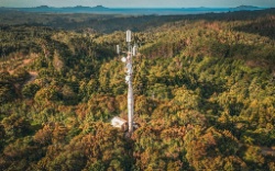 Bill Bennett: Wireless Carriers Push Back On Fibre-First Rural Broadband
 Stats NZ: Petrol And Diesel Prices Continue To Rise In April 2026
 Priority one: Regional Deal Strengthens Confidence In The Western Bay Of Plenty
 REINZ: Buyer Activity Softens As Living Costs Remain A Consideration Across Key Regions
 Better Taxes for a Better Future: Tax Policy Welcome Contribution, But Missed Opportunity To Tackle Wealth Inequality
 Google Threat Intelligence Group - GTIG: Google Threat Report Warns AI-Driven Cyber Operations Are Scaling Across Global Threat Landscape