 Scoop has an Ethical Paywall


Rain continues in sodden district
Rain continues in sodden district
Slips, surface flooding and fallen trees continue to hound Gisborne today, reflecting the saturated, sodden state of the district.
As more of the expected 150mm rain continued to fall in the ranges, Gisborne Civil Defence controller Jon Davies called for caution on the district’s roads.
“With the continuing rain, drains throughout the district are running to capacity, creating the occasional surface flooding of roads. Drivers need to be particularly careful of surface flooding. We advise people drive to the conditions.”
“The district is now quite soaked to the north, with the land having reached saturation point. We are keeping a close eye on the flats north of Tolaga Bay, at Te Karaka and Manutuke.”
Since midnight Sunday, more than 220mm of rain has fallen in some parts of the region, notably 260mm inland from Ruatoria, 233mm at Waikura Valley and 225mm north of Tolaga Bay. Highest falls since midnight last night were north of Tolaga Bay, with falls of between 70 and 100mm. Nearly 100mm has also fallen at Muriwai and 80mm at Waerenga o kuri.
River levels reached warning levels earlier today but have since levelled out. The Waipaoa River at Kanakanaia had dropped slightly to 6.1m, Hikuwai River at Willow Flat was at 10m – having peaked early this morning at 11.1m – the Waimata at 4.8m and Te Arai, 2.1m. Manutuke incurs problems when the Te Arai reaches 2.5m; the Hikuwai floods over State Highway 35 at 12m.
At least another 18 hours of rain is expected across the district with another 100 to 150mm in the ranges and another 50 to 80mm in coastal areas and the city.
If the Waipaoa River continues to rise, there could be problems In the Te Karaka area. The highway at Puha floods when the river reaches 7m, and at Nesbitt’s Dip at 8.3m.
This morning, Gisborne District Council staff were working to reopen seven roads closed by slips and surface flooding. The Matahiia Road was closed until further notice and delays of up to half an hour were expected for traffic on Tauwhareparae, Fernside, Mata and Ihungia roads.
Mr Davies said residents should listen to their radio for updates as Civil Defence monitored river levels.
Comprehensive information regarding weather, rainfall, river levels and road closures is available on council’s website at www.gdc.govt.nz.
ENDS
 Gordon Campbell: On The Risks Of AI In The Workplace
 Tauranga City Council: Mauao Restoration Work Has Begun
 Horizon Research: New Poll Finds High Concern About Fuel Situation
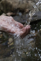 Tiaki Wai: Over 1,150 People Give Feedback On Tiaki Wai Water Services Strategy
 Greenpeace Aotearoa: Israeli Forces Illegally Attack Peaceful Humanitarian Flotilla
 Zero Waste Network: Container Return Scheme Bill Could Save Councils $50m A Year And Put Money Back In Households
 Office of the Privacy Commissioner: Privacy Commissioner Does Not Support Policing Amendment Bill