Gale Force Winds And Huge Seas To Accompany Cyclone Cody
Ex-Tropical Cyclone Cody has veered further East overnight, sparing the Coromandel the worst of the direct impact. However, we aren’t out of the woods just yet. Cyclone Cody is still going to deliver a few wild and windy days ahead.
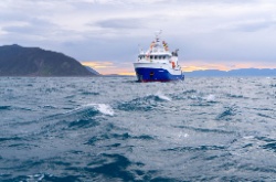
MetService is forecasting the Coromandel will still experience gale force winds, huge seas, and heavy rain from Sunday night through to next Tuesday.
“We still need to be extremely cautious over the next few days and plan ahead” says our Civil Defence Controller Garry Towler.
Our Council’s Emergency Management Team is advising everyone to plan and be in a safe place by late afternoon on Sunday with supplies for last for 24 hours, including provisions if power is out for some time.
Camper vans and motor homes need to move away from the coast for the next two days and park up at two safe locations; the Mercury Bay Sports Park in Whitianga, or the Shoppers carpark next to Goldfields Mall in Thames.
Keep connected to MetService and our Council’s Facebook for more regular updates.


 Gordon Campbell: On How US Courts Are Helping Donald Trump Steal The Mid-Terms
 Office of the Ombudsman: Ombudsman Publishes Findings On Ministry Of Education Sensitive Claims Scheme
 Nelson City Council: Mayor Welcomes Auditor-General Decision Not To Prosecute Councillor
 Johnnie Freeland: Ko Tātou Tātou - Climate Action In Aotearoa Begins With Relationship
 Zero Waste Network Aotearoa: Container Return Scheme Bill Would Double Recycling Rates And Put Money Back In Households
 Wellington City Council: Statement From The Wellington Mayoral Forum On Options For Regional Governance Reform
 MUNZ: TAIC Report On Kaitaki Incident Gives Shocking Picture Of Decline Of NZ Maritime Infrastructure


