 Scoop has an Ethical Paywall


People Urged To Stay Away From Beaches
People throughout the region are still being urged to keep out of the water and away from the coast as Tairāwhiti braces for the main impacts of Cyclone Cody which are likely to hit on Monday.
Civil Defence emergency manager Ben Green says strong winds are still being forecast for the region despite evidence that Cyclone Cody is now tracking east of Tairāwhiti.
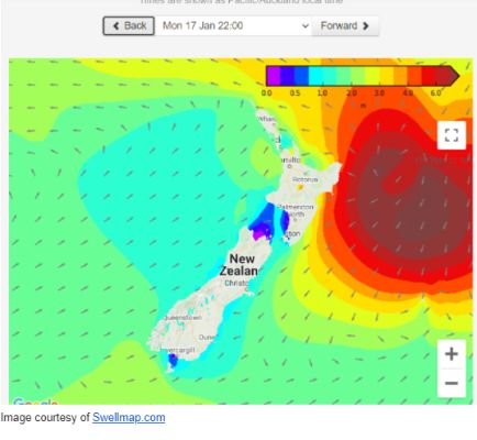
“Significant and hazardous waves are expected tomorrow (Monday) with the potential for dangerous rip currents inshore and unpredictable surges. This means it is not safe for people to be in the water at this time and we urge them to stay on land.”
The tsunami advisory for eastern coastal areas as a result of the earthquake and eruption in Tonga on Saturday, is still in effect and has the potential to add to the complex sea conditions the region is likely to see in the next 24 hours.
Mr Green says conditions are likely to ease on Tuesday but until then it‘s important people remain alert and keep informed about the latest forecasts and warnings from Metservice.
Council’s principal scientist Dr Murry Cave says while the tsunami surges in Gisborne have not been as significant as Northland there are still strong currents and vigorous eddies affecting local beaches with overall water levels already higher than normal due to storm surge from Cyclone Cody.
“The tsunami surges have not affected any coastal properties but some scouring of sand dunes at the top of beaches was observed today and a lot of sea weed pushed up towards the top of beaches between Pouawa and the city beaches,” said Dr Cave. “Rocks with gooseneck barnacles attached were thrown up among the seaweeds at Wainui Beach.”
“High tide at 5.30pm is the critical time with possible tsunami currents and storm surge from Cody building with three metre plus swells on top of the tide. Big swells are expected overnight and the high tide early on Monday morning is when the storm surge is likely to be five to six metres on top of the tide.”
Metservice has advised that Cyclone Cody is tracking well to the east of the country and says while the heavy rain warning for the region has been lifted, strong winds are still likely.
 Gordon Campbell: On How US Courts Are Helping Donald Trump Steal The Mid-Terms
 Forest And Bird: Government Biodiversity Credit Scheme Welcomed As Opportunity For Restoration
 Office of the Ombudsman: Ombudsman Publishes Findings On Ministry Of Education Sensitive Claims Scheme
 Nelson City Council: Mayor Welcomes Auditor-General Decision Not To Prosecute Councillor
 Johnnie Freeland: Ko Tātou Tātou - Climate Action In Aotearoa Begins With Relationship
 Zero Waste Network Aotearoa: Container Return Scheme Bill Would Double Recycling Rates And Put Money Back In Households
 Wellington City Council: Statement From The Wellington Mayoral Forum On Options For Regional Governance Reform