 Scoop has an Ethical Paywall


Landslide Dam Along Tauwhareparae Road Assessed Low-risk
A landslide dam on Tauwhareparae Road has been assessed as low to minimal risk of failure.
The dam formed after the heavy rain event in June when landslides caused massive damage to the rural road that sits inland between Uawa and Whatatutu.
Gisborne District Council Principal Scientist Dr Murry Cave says the dam of water is being actively monitored and inspected, especially after rain.
“The landslide dam itself is quite small at 1.2Ha, and water is freely flowing through it which reduces risk.
“The gradient on the dam is low, which also reduces the risk of rapid failure.”
Dr Cave says this type of feature is expected to break down gradually over the next few months.
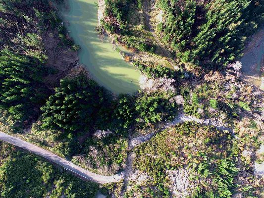
The dam has been assessed as having 26,000 m3 of water in it and measures 5m deep and 20m wide, and is pictured below.
 Gordon Campbell: On Children’s Book Classics - The Moomins
 Johnnie Freeland: Ko Tātou Tātou - Climate Action In Aotearoa Begins With Relationship
 Zero Waste Network Aotearoa: Container Return Scheme Bill Would Double Recycling Rates And Put Money Back In Households
 Wellington City Council: Statement From The Wellington Mayoral Forum On Options For Regional Governance Reform
 MUNZ: TAIC Report On Kaitaki Incident Gives Shocking Picture Of Decline Of NZ Maritime Infrastructure
 Greenpeace: New Climate Report Yet More Reason To Reduce Dairy Herd
 Better Public Media: Opposing Plans To Scrap The BSA