 Scoop has an Ethical Paywall


SuperComputer Weather: Hurricane Isabel's Landfall

NASA MODIS - Satellite: Terra 2003/258 - 09/15 at 15 :30 UTC
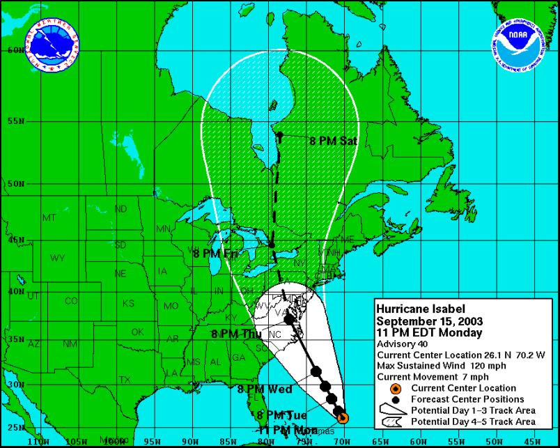
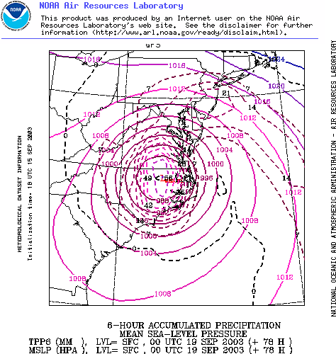
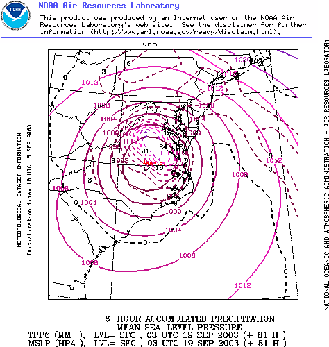
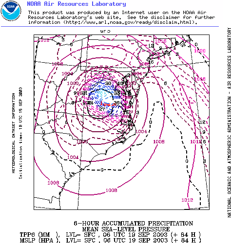
As Hurricane Isabel approaches the Eastern Seaboard computer models are converging on a Cape Hatteras landfall in just under 70 hours time. Massive rainfall in the first six hours can be expected to cause widespread flooding in North Carolina and Virginia.

NASA MODIS - Satellite: Terra 2003/258 - 09/15 at 15 :30 UTC
SOURCE -
National Hurricane Center
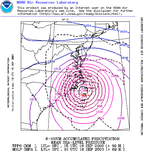
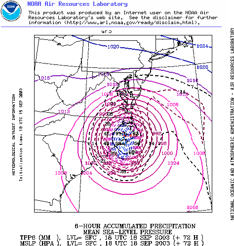
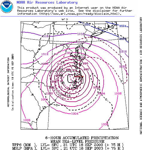
LATEST NOAA GFS SUPER
COMPUTER MODEL TRACK
Each image shows rainfall
in coloured lines…
+69 HOURS
+72 HOURS
Note: the windspeeds indicated in the
graphic linked above are far lower than actual expected
winds of over 100 knots. See National Hurricane Center Wind
Forecasts…
FORECAST POSITIONS AND MAX WINDSINITIAL 16/0300Z 26.1N 70.2W 105 KT
12HR VT 16/1200Z 26.9N 70.8W 105 KT
24HR VT 17/0000Z 28.4N 71.7W 100 KT
36HR VT 17/1200Z 29.8N 72.5W 100 KT
48HR VT 18/0000Z 31.5N 73.7W 100 KT
72HR VT 19/0000Z 37.2N 77.2W 60 KT...INLAND
96HR VT 20/0000Z 44.5N 79.5W 40 KT...INLAND...EXTRATROPICAL
120HR VT 21/0000Z 54.0N 78.5W 30 KT...INLAND...EXTRATROPICALSource - National Hurricane Center
+75 HOURS
+78 HOURS
+81 HOURS
+84 HOURS
 Keith Rankin: 'I Am A Semite'
 Binoy Kampmark: Show Me The Money - A Loutish Administration Confronts A Craven Congress
 Ian Powell: Do Wellington Floods, Climate Change And Wealth Accumulation Equal “Suicidal Capitalism”?
 Ramzy Baroud: The Pendulum Swings - The Slow Death Of Europe’s Pro-Israel Consensus
 Dr Nasim: Poem From Gaza - Her Smile
 Keith Rankin: New Zealand's Dependence - Wheat, Rice, Fuel, Ships