 Scoop has an Ethical Paywall


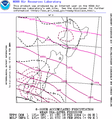
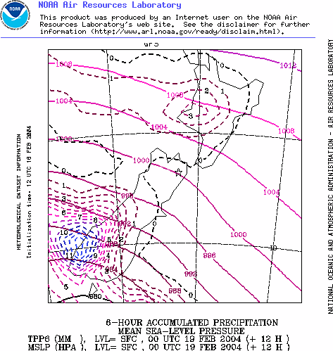
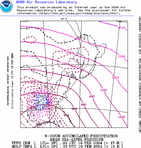
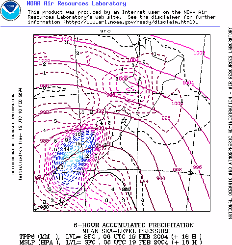
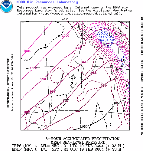
Supercompter Weather: Plotting The Coming Storm
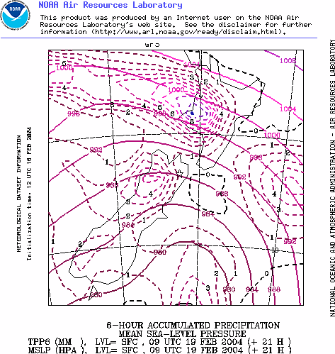
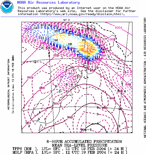
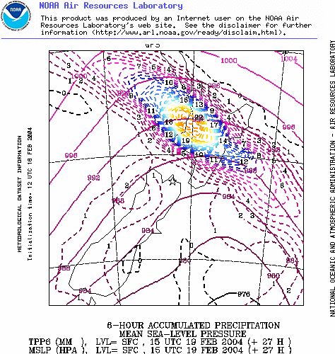
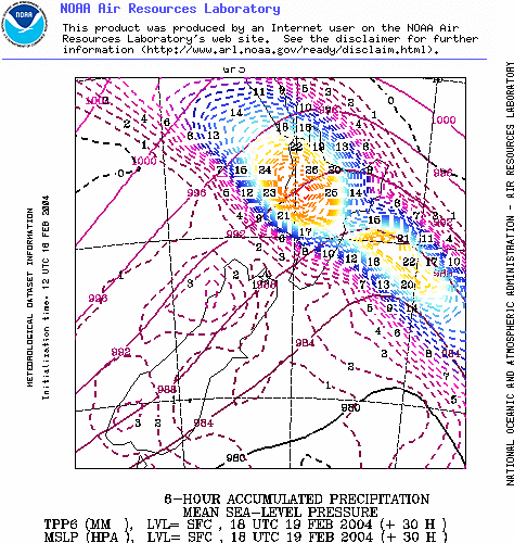
The following progression of images shows the progress of the coming front over New Zealand as plotted by the National Oceanic and Atmospheric Administration's supercomputer GFS model. The images are plotted three hourly and they show air pressure and rain patters. The rain patterns are shown in the coloured lines.
Interestingly the current official Met Service wind and rain warning " A Burst Of Heavy Rain And Strong Winds Today " shows a slightly different story about this storm. Their prediction shows brunt of the storm making landfall between Taranaki and Wellington while the images below show Taranaki, the Waikato and Auckland receiving the heaviest rainfall.
WARNING: The following is not produced by a professional meteorologist and is rather a simple dump of NOAA weather supercomputer data. The official Met Service forecast is based on several supercomputer models plus the expert knowledge of Met Service forecasters.
 Richard S. Ehrlich: Strait Of Hormuz Blockades & Thailand's Land Bridge
 Keith Rankin: 'I Am A Semite'
 Binoy Kampmark: Show Me The Money - A Loutish Administration Confronts A Craven Congress
 Ian Powell: Do Wellington Floods, Climate Change And Wealth Accumulation Equal “Suicidal Capitalism”?
 Ramzy Baroud: The Pendulum Swings - The Slow Death Of Europe’s Pro-Israel Consensus
 Dr Nasim: Poem From Gaza - Her Smile