 Scoop has an Ethical Paywall


Google and GeoEye: Images from Christchurch
February 25, 2011
Google Earth Imagery: Christchurch
New satellite imagery available from our partners at GeoEye.
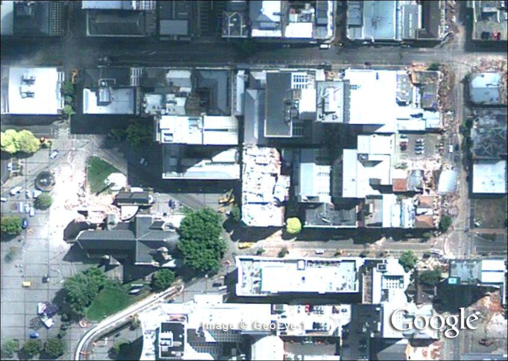
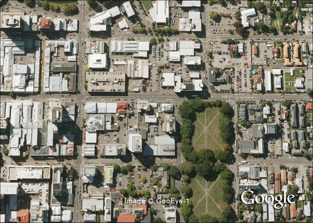
Imagery of Christchurch was taken on Thursday, February 24th from the GeoEye-1 satellite. Some parts are covered in clouds but substantial portions of the central business district are clearly visible. Remember to turn the layer on and off to compare it with our previous imagery, which is from March 2009.

Click for big version
Church Before
Click for big
version
Collapsed Church and Surrounding
Buildings
Click for big
version
Park and Buildings Before

Click for big
version
Park and Collapsed
Buildings
Links
Album of high-res still images of Christchurchhttps://picasaweb.google.com/118079222830783600944/Christchurch?authkey=Gv1sRgCLDdz8PWg5KzhwE&feat=directlink
KML to open in Google Earth
Central and Northern Christchurch: http://mw1.google.com/crisisresponse/2011/christchurch/earthquake/geoeye/christchruch_2011-02-23_scene2v2/christchruch_2011-02-23_scene2v2kml
Southern Christchurch: http://mw1.google.com/crisisresponse/2011/christchurch/earthquake/geoeye/christchruch_2011-02-23_scene1v2/christchruch_2011-02-23_scene1v2.kml
Central Tripoli: http://mw1.google.com/crisisresponse/2011/libya/other/geoeye/tripoli_2011-02-24_scene2/tripoli_2011-02-24_scene2.kml
Eastern Tripoli: http://mw1.google.com/crisisresponse/2011/libya/other/geoeye/tripoli_2011-02-24_scene1v3/tripoli_2011-02-24_scene1v3.kml
 Keith Rankin: Has Sweden Become A De Facto Apartheid Narco State?
 Bruce Mahalski: Change In The Weather #194
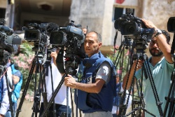 Binoy Kampmark: Dangers To The Fourth Estate - The 2026 World Press Freedom Index
 Richard S. Ehrlich: Strait Of Hormuz Blockades & Thailand's Land Bridge
 Keith Rankin: 'I Am A Semite'
 Binoy Kampmark: Show Me The Money - A Loutish Administration Confronts A Craven Congress