 Scoop has an Ethical Paywall


FAO And Samoa Harness Satellite Technology To Strengthen Agricultural Data And Food Security
08/05/2024, Apia, Samoa – The Government of Samoa and the Food and Agriculture Organization of the United Nations (FAO) are integrating Earth Observation and geospatial technologies into national agricultural data systems to improve resilience and support evidence-based policymaking.
Samoa’s agricultural landscape is highly mixed and diverse, yet it has not previously been mapped or monitored at high spatial resolution. National agricultural data has historically relied on household surveys, which, while valuable, do not capture the spatial patterns of crop cultivation, the extent of national cropland, or the year-to-year changes required for modern agricultural planning.
To address these gaps, FAO is supporting the integration of field-based-crop-type and yield observations with high resolution satellite and drone imagery, combined with machine-learning algorithms. This enables Samoa to generate its first agricultural land-use and crop-type maps, produce crop yield estimates and track land-use changes over time. These innovations form part of FAO’s Earth Observation for Statistics (EOSTAT) initiative, which helps countries integrate satellite data into official statistics and enhance the monitoring of SDG 2 (Zero Hunger) and SDG 15 (Life on Land).
“Reliable, timely agricultural data is the foundation of resilient food systems. Through this partnership, Samoa is showing how Pacific nations can harness Earth Observation and geospatial technologies to make better-informed decisions for their farmers, communities and economies. FAO is proud to support this transformation and stands ready to scale these innovations across the region.” - Mr Guangzhou Qu, FAO Subregional Coordinator for the Pacific Islands and FAO Representative for Samoa.
Building national capacity and skills for the future
In October 2025 and as part of the initiative, FAO trained 20 officers from the Samoa Bureau of Statistics (SBS) in digital field data collection, remote-sensing fundamentals, and the use of the QField mobile application. This training enables the national staff to independently collect the foundational data required for large-scale cropland mapping. For many participants, it was their first hands-on engagement and experience with advanced geospatial tools.
Following the training, four field teams travelled across the islands of Upolu and Savai‘i, collecting more than 4 500 GPS-tagged points and 300 crop-boundary polygons using mobile tablets and high-resolution satellite imagery. These data are essential for training machine-learning models that distinguish between crop and non-crop land cover and will underpin Samoa’s national crop maps.
In December 2025, FAO and Université Catholique de Louvain (UCLouvain) delivered a four-day technical workshop to deepen national expertise in agricultural mapping and monitoring. The training equipped national technical staff with practical skills in using Earth Observation data for land-use and crop mapping, yield estimation, and geospatial analysis.
Most recently, from 28 to 30 April 2026, six technical officers from SBS, MAF and FAO further strengthened their expertise through specialized training on the senseFly eBee X drone system, delivered by Falcon UAV. These activities form part of the Samoa Agricultural Data Project, which aims to enhance national capacity through the integration of Earth Observation and geospatial technologies into official statistics.
A foundation for stronger food-security planning
By combining high-resolution drone imagery with satellite data, Samoa will be able to produce detailed agricultural land-use and crop-type maps, improve the accuracy of surveys and yield forecasting, and strengthen resilience to climate variability and change. Crucially, this investment in technical capacity ensures that the tools can be sustainably managed by the Government of Samoa, supporting long-term agricultural planning and food security.
The resulting crop-cultivation data will feed directly into Samoa’s agricultural statistics and support national priorities under the Samoa Agriculture Sector Plan and the Pathway for the Development of Samoa (PDS 2021–2026). It will also contribute to regional efforts under the Pacific Strategic Plan for Agricultural and Fisheries Statistics (P-SPAFS).
“This collaboration marks a turning point for Samoa’s agricultural data systems. Through the integration of satellite imagery, drone technology, and field data, we are strengthening our ability to produce timely, reliable, and spatially detailed agricultural statistics. This will significantly enhance evidence-based policymaking and improve our understanding of agricultural performance across the country. These advancements will directly support better outcomes for our farmers and communities” - Mr. Leota Aliielua Salani, Government Statistician, Samoa Bureau of Statistics.
By the end of 2026, the project will deliver baseline agricultural maps and crop-yield estimates validated with field data, a georeferenced farm-registry database, and a national training package on Earth-Observation-based agricultural monitoring for SBS and MAF. The initiative reinforces the Government of Samoa’s commitment to sustainable and resilient food systems.
About FAO in the Pacific Islands:
The Food and Agriculture Organization of the United Nations (FAO) is the specialized UN agency that has been leading international efforts to defeat hunger and malnutrition for 80 years. Since 1996, Samoa has been hosting the FAO Subregional Office for the Pacific Islands in its capital, Apia. This office is responsible for developing, overseeing, and implementing programmes and projects to address food security, nutrition, agriculture, and rural development priorities in the Cook Islands, the Federated States of Micronesia, Fiji, Kiribati, the Marshall Islands, Nauru, Niue, Palau, Samoa, Solomon Islands, Tonga, Tuvalu, Vanuatu, as well as the territory of Tokelau, an Associate Member.
 Global Sumud Flotilla: Saif Abukeshek & Thiago Ávila Released - Victory For International Mobilization; A Reminder Of Who Remains Behind
  Aotearoa Delegation of the Global Sumud Flotilla: The Global Sumud Flotilla Remains Undeterred As Over 30 Boats Depart For Türkiye
 UN Special Procedures - Human Rights: Israel Must Immediately Release Gaza-Bound Flotilla Activists, Say UN Experts
 IPMSDL: Condemn The Killing Of Children, Bombing In Manipur, And Violent Repression Of People’s Protests
 Médecins Sans Frontières: Three Years On, Outbreaks Everywhere - MSF Urges Boost To Sudan’s Vaccination Programs
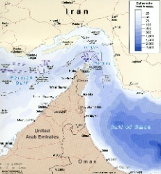 UN News: Uncertainty Continues Over Safety In The Strait Of Hormuz