 Scoop has an Ethical Paywall


Fine for most on Waitangi Day
MetService News Release
05 February
2018
Fine for most on Waitangi Day
A cooler
southwesterly flow is spreading across the country today
(Monday), bringing showers to the west and south and even
some snow for the higher ranges of the South Island.
Meanwhile the upper North Island is in for another round of
scattered thunderstorms and potential downpours and
MetService has issued a Thunderstorm Watch for today
(Monday) for Bay of Plenty, Coromandel, and eastern parts of
Auckland and Waikato.
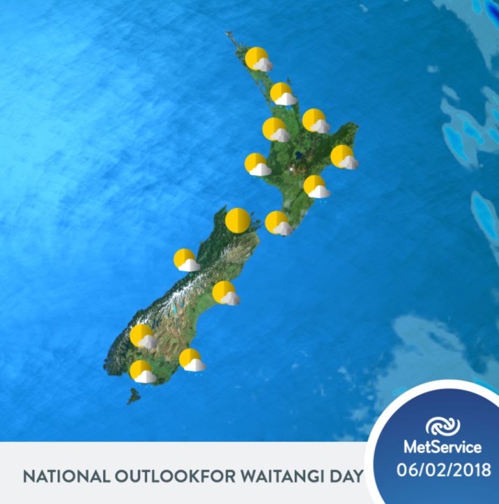
Most of this activity eases away tonight and then there is lot of fine weather about the country for Waitangi Day. A few showers remain, mainly in the south and east of the South Island and southwest of the North Island. Another cool day in the south, with Southland and coastal Otago centres struggling into the mid-teens.
“It is looking dry and generally sunny for the ceremonies at Waitangi”, said forecaster Cameron Coutts, “with a breezy southwesterly and temperatures heading to around 26 degrees”.
Fine weather over the South Island as we head towards the weekend. Meanwhile, another tropical system moves down over the northern Tasman Sea, with a strong and moist northeasterly flow setting in over the upper North Island on Thursday and Friday.
“Winds may reach gale force in Northland and heavy rain is also possible there on Thursday and Friday” commented Coutts.
 Google Threat Intelligence Group - GTIG: Google Threat Report Warns AI-Driven Cyber Operations Are Scaling Across Global Threat Landscape
 Commerce Commission: Baseline Research Report On The State Of Competition In New Zealand
 University of Auckland: Junk Food Designed To Make Us Eat More, Study Finds
 Spark: New Report Sets Out Outcomes-Led Approach To Lift Rural Connectivity Using The Right Mix Of Technologies
 Bill Bennett: Fixed Voice Rules Head For Deregulation
 UN Department of Global Communications: United Nations Proposes New Global Dashboard To Measure Progress Beyond GDP