 Scoop has an Ethical Paywall


The Big Wet Continues for Hawke's Bay
Hawke's Bay Civil Defence & Emergency Management Group | Media Release # 3 27 April 2011
The Big Wet Continues for Hawke's Bay
Hawke's Bay is well and truly wet, but
the Regional Council advises there is still more rain to
fall over the coming days.
Coastal areas have been particularly hard hit, with evacuations from Nuhaka, Te Awanga, Ocean Beach, Clifton and Waimarama. Some bridges are under water or washed out along with slips and surface flooding in many places.
Council staff will be working through the night monitoring the situation, also manning fixed and mobile pumps, with a digger and truck on call if required. The Hawke's Bay Regional Council Emergency Operations Centre is active, as are those of Hastings District and Central Hawke's Bay. Other councils are active and monitoring the situation should it change.
From 6.00pm Wednesday to midday Thursday, expect continued rainfall throughout Hawke's Bay with up to another 70mm in the coastal communities south of Cape Kidnappers; up to another 40mm inland in Central Hawke's Bay; and up to another 100mm in the Wairoa catchment. Although there have been no swell warnings issued, the significant wave height is currently 3.7m (Port of Napier), with a period of 10 seconds. This has the potential to cause damage to exposed coastal locations.
Depending on rainfall levels, minor streams and tributaries will rise and fall quickly. However the region's main rivers are not expected to pose a problem. People in affected areas should stay at home where possible, avoid unnecessary travel and be wary of possible soil movement and further slips.
POWER & WATER Waimarama power out overnight; water treatment plant also without power.
Known power outages at Kairakau, Mangakuri, Southern Pourerere Beach, Aramoana, and Blackhead.
ROAD CLOSURES & ACCESS WAIROA DISTRICT State Highways north and south (SH2 and SH38) have been reopened. SH2 Wairoa to Gisborne has been open all day there may be patches of silt/debris where there has been surface flooding.
HASTINGS DISTRICT SH5 Napier to Taupo remains open SH2 Napier to Wairoa is open - two lanes have been restored, worst affected areas are White Pine Bush/Devils Elbow area. Roads are likely to be slippery, expect areas of surface water Ocean Beach Road marginal access (slip)- closed overnight. Clifton Bridge, Te Awanga closed, camping ground isolated Waimarama Road closed due to slip and bridge approach washout. Maraetotara Road closed
NAPIER Surface flooding across Napier with substantial ponding at Bay View No issues with access, although some slips and debris around Napier Hill - barriers are in place where needed.
CENTRAL HAWKE'S BAY There is currently no road access to the coastal communities of: Kairakau Mangakuri Pourerere Aramoana Blackhead Te Paerahi Porangahau Whangaehu
And the inland communities of: Omakere Elsthorpe Long Range
[ENDS]
 Gordon Campbell: On The Risks Of AI In The Workplace
 Dayenu: Condemning Use Of Government Funding For Extremist Report On Antisemitism
 PSA: Councils Must Work With Unions And Communities In Fast-Track Reform
 Tauranga City Council: Mauao Restoration Work Has Begun
 Horizon Research: New Poll Finds High Concern About Fuel Situation
 Tiaki Wai: Over 1,150 People Give Feedback On Tiaki Wai Water Services Strategy
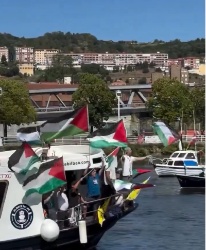 Greenpeace Aotearoa: Israeli Forces Illegally Attack Peaceful Humanitarian Flotilla