 Scoop has an Ethical Paywall


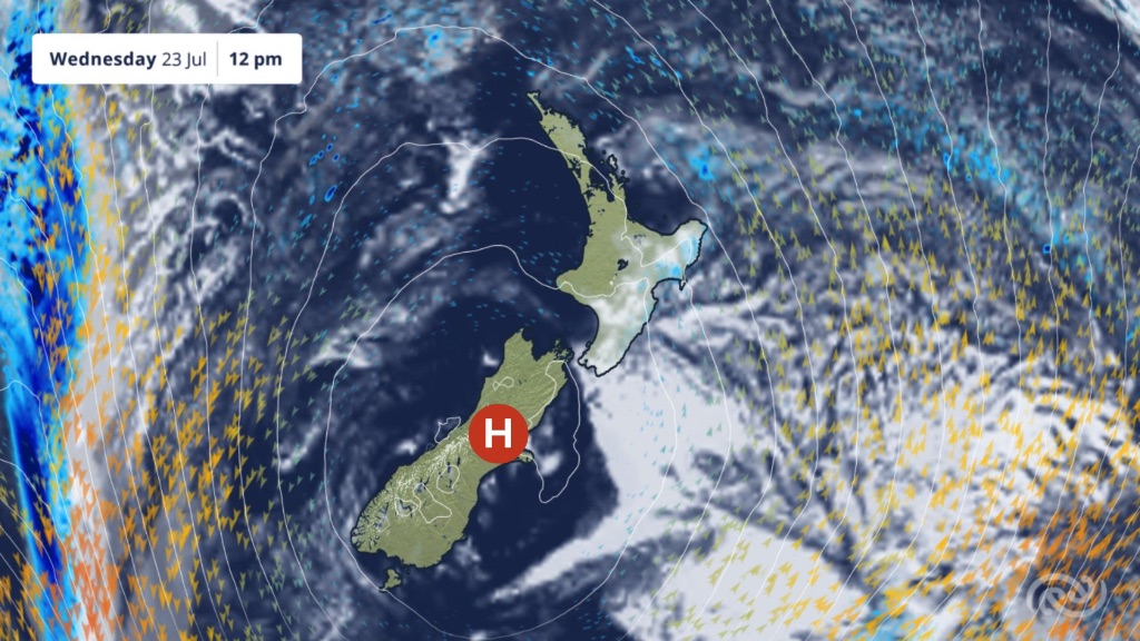
Clear Skies And Frosty Mornings Sticking Around This Week
Covering period of Monday 21st - Thursday 24th
July
• Settled weather for most
• Showery
first half of the week for eastern North Island
• Fog
may hang around in inland South Island valleys through the
week
Settled weather is set to persist through the week over New Zealand as a high-pressure system sits over the country. After wetter conditions in some areas over the past few weeks, some may welcome the return of calmer, drier weather.
MetService meteorologist Oscar Shiviti says, “this week is a great time to enjoy outdoor activities, especially while some are still busy at school, as clear skies and light winds are expected for most regions”.
Shiviti continued, “the fine weather this week does come with a downside of cold, frosty mornings”. The clear skies and calm conditions, as a result of the high-pressure system, allow for temperatures to drop overnight, particularly in inland areas.
This morning (Monday) was especially chilly, “with Christchurch recording its coldest July temperature so far at -3.8°C, and Taumarunui reaching its lowest temperature of the year at -3.6°C” added Shiviti. These frosty starts are expected to continue throughout the week, especially in the Mackenzie District as well as in Otago, which may experience the coldest mornings, along with possible fog. Twizel drops to -5°C on Tuesday and Wednesday morning, while inland parts of Dunedin wake up to a frosty -3°C.
While the coldest temperatures will be found in the South Island, “frosty conditions are expected widely across the North Island too, even parts of the Auckland region could wake up to a touch of frost on Tuesday morning" Shiviti added.
Although most of the country will stay dry, there are still a few areas that could see some wet weather. The east of the North Island, such as Tairāwhiti Gisborne and Hawke’s Bay, sees cloudier and showery conditions through to Wednesday night due to southeasterly winds bringing moisture in from the ocean.
Later in the week, a front is expected to approach from the Tasman Sea, meaning there is a chance of a shower or two in the southwest of the South Island for the second half of Thursday. Showers and rain should become more pronounced in Fiordland by Friday as the front arrives.
For more on the weather keep an eye on the MetService website (www.metservice.com).
 Gordon Campbell: On Children’s Book Classics - The Moomins
 Nelson City Council: Mayor Welcomes Auditor-General Decision Not To Prosecute Councillor
 Johnnie Freeland: Ko Tātou Tātou - Climate Action In Aotearoa Begins With Relationship
 Zero Waste Network Aotearoa: Container Return Scheme Bill Would Double Recycling Rates And Put Money Back In Households
 Wellington City Council: Statement From The Wellington Mayoral Forum On Options For Regional Governance Reform
 MUNZ: TAIC Report On Kaitaki Incident Gives Shocking Picture Of Decline Of NZ Maritime Infrastructure
 Greenpeace: New Climate Report Yet More Reason To Reduce Dairy Herd