 Scoop has an Ethical Paywall


Weather Settles For Anzac Weekend After Turbulent Week
23/04/2026
Covering period of Thursday 23 -
Monday 27 April
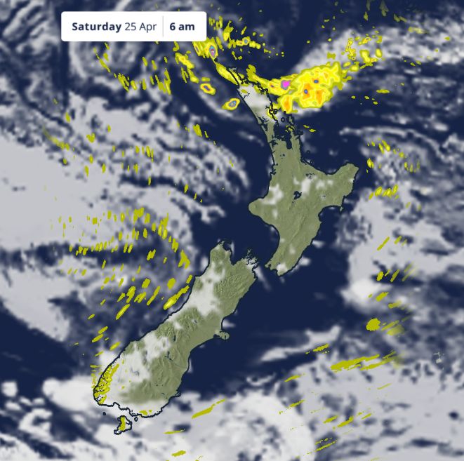
- Heavy Rain Warnings for eastern Northland from Hikurangi to eastern Auckland north of Whangaparaoa, and Great Barrier Island.
- Weather settles for most of Aotearoa after a week of severe conditions
- Anzac Day dawn services largely dry conditions but cold, especially inland
- Fine weather continues into Monday, with only isolated showers in the south and west.
After a week that began with thunderstorms, intense downpours, gusty winds and even tornadoes, the weather is set to calm down as we head into Anzac Weekend. The majority of the country is expected to see drier conditions, although some rain will linger across the top of the North Island for Friday, where Severe Weather Watches and Warnings remain in place.
MetService meteorologist John Law says, “For most of the country, high pressure will bring some very welcome settled weather this weekend.”
“However, a band of rain will brush the top of the North Island overnight tonight and tomorrow (Friday), keeping Northland, Auckland and the Coromandel on the wetter side.”
A Heavy Rain Warning covers Great Barrier Island and the area of eastern Northland and eastern Auckland between Hikurangi and Whangaparaoa for Thursday night into Friday and Heavy Rain Watches are in place for eastern Northland, south of the Bay of Islands, and the Coromandel north of Whitianga.
On Saturday, communities across Aotearoa will gather to mark Anzac Day. For most regions, the day is expected to be dry, though a few early morning showers are possible around the eastern coast of Northland, which could affect some dawn services.
“Dawn services are looking mostly dry, but it will be a cold start, especially inland,” says Law. “Waiouru is set to be one of the coldest spots, with temperatures around 1°C at daybreak.”
While nights will remain chilly, plenty of sunshine will help lift daytime temperatures, particularly across the eastern South Island. After a run of cooler days, Canterbury and Otago are expected to be the warmest parts of the country this weekend, with Dunedin forecast to reach around 22°C on Saturday, about five degrees above average for this time of year.
For the final day of the long weekend, high pressure stays in charge. “Monday continues the settled theme for most regions,” says Law. “There will be a few showers pushing into Southland and parts of the West Coast, but for many, especially those recently affected by severe weather, it will be a welcome break.”
 Gordon Campbell: On Pauline Hanson’s Rise, And The TOP Renaissance
 Hapai Te Hauora: New Online Gambling Laws Could Grow Harm While Claiming To Reduce It
 New Zealand Alliance Party: Alliance Party Firmly Opposes “Backdoor Privatisation” Of Kiwibank
 Taxpayers' Union: New Poll - Coalition Still Ahead; Luxon Regains 'Preferred Prime Minister' Top-Spot
 NZ National Party: Judith Collins’ Valedictory Speech
 Forest And Bird: Government Biodiversity Credit Scheme Welcomed As Opportunity For Restoration
 Office of the Ombudsman: Ombudsman Publishes Findings On Ministry Of Education Sensitive Claims Scheme