 Scoop has an Ethical Paywall


Tree Cover For Kiwi Towns And Cities Spotlit In New Study
How leafy is your hometown?
Researchers from Te Whare Wānanga o Waitaha | University of Canterbury (UC) have the answer after completing urban tree canopy cover assessments for 75 towns and cities across Aotearoa New Zealand.
Led by Professor Justin Morgenroth and Dr Ning Ye from the UC School of Forestry, the project team used aerial imagery and LiDAR (light detection and radar) data to assess how much land area is covered by tree canopy.
Te Uru Rākau New Zealand Forest Service provided funding to support a team of UC student interns; Maggie Crawford, Jean Morton, Tuawhio Porima and Stephen Thompson, to help carry out the work.
The results show that urban tree canopy cover across the 75 towns and cities ranges from 7.5% in Hāwera to nearly 59% in Picton, highlighting significant variation and the potential for future planting. The average across all towns and cities was 19%.
The findings have been used to create customised reports for local councils across the country, detailing forest cover within their urban boundaries.
“Urban tree canopy— the layer of leaves, needles, and branches that cover the ground when viewed from above—plays a vital role in the health, sustainability, and resilience of our towns and cities,” Professor Morgenroth says. “It provides many benefits, including climate change mitigation, reducing air pollution, improving water quality and providing habitat for wildlife.
“Research has shown that for every $1 invested in urban trees, trees will return $3.40 in benefits. We hope this work will spark conversations within councils and communities about how to protect, grow, and plan for more trees in cities.”
The reports outline how each council can build on the findings, such as setting canopy targets, conducting neighbourhood-level mapping, and engaging with schools or community groups in greening efforts.
Urban tree canopy cover in Auckland, Wellington and Christchurch, has previously been mapped using a different method, with Wellington having the highest canopy cover at 31%, followed by Auckland at 18% and Christchurch with 14%.
Professor Morgenroth says the differences in canopy cover between the various towns and cities can be the result of population, climate, development history, and surrounding land uses.
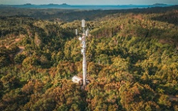 Bill Bennett: Wireless Carriers Push Back On Fibre-First Rural Broadband
 Stats NZ: Petrol And Diesel Prices Continue To Rise In April 2026
 Priority one: Regional Deal Strengthens Confidence In The Western Bay Of Plenty
 REINZ: Buyer Activity Softens As Living Costs Remain A Consideration Across Key Regions
 Better Taxes for a Better Future: Tax Policy Welcome Contribution, But Missed Opportunity To Tackle Wealth Inequality
 Google Threat Intelligence Group - GTIG: Google Threat Report Warns AI-Driven Cyber Operations Are Scaling Across Global Threat Landscape