 Scoop has an Ethical Paywall


Moving SH-1 in to an earthquake HIGHER risk zone
Moving SH-1 in to an earthquake HIGHER risk zone
By Colin Baxter
I know that the Tsunami story was featured in the national and local media recently.
I have mocked up SH-1 (eastern) and Kapiti expressway (western) on to a GWRC earthquake map. This is picture-1
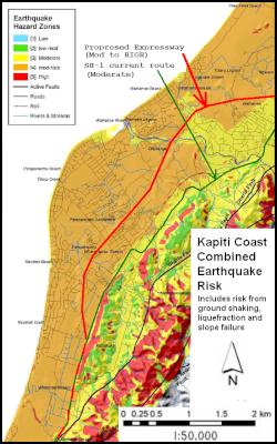
Take a few minutes to study the implications.
SH-1 (eastern) in on moderate risk land (yellow)
Proposed expressway (western) is on mod to HIGH risk land (dark yellow).
I suspect this is a liquefaction issue with it being sand and wetlands etc.
I also marvel at our predecessors who chose the eastern route without today's knowledge and high tech gadgets. But then the wetland would have been obvious to them at that time.
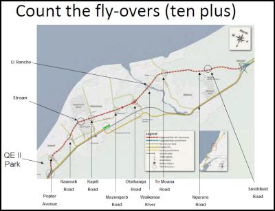
One key fact is that this new route will require numerous (10+) fly-overs which the WLR will not. This is picture-2 Each of these is at risk of collapse and will block escape routes.
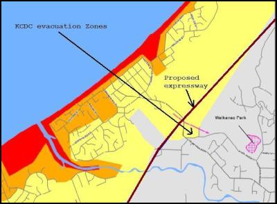
This puts to the sword NZTA's previous comment about climbing to the top of the bridge to be safely away from the Tsunami. This is picture-3
Again did NZTA know this information and not release it during consultation phase 1 (Oct 2009) or phase 2 (Feb 2011)?
Have they told the Minster of Transport of this twin danger and if so what was his reaction ? Does the Associate Transport minister and local MP Nathan Guy know this increased risk and if so what has he to say about this?
NZTA also need to state what size earthquake they propose to engineer each of the fly-overs (and ramps) to withstand. This will add to the cost and delay the timing.
Just in case NZTA try to down-play this story, I also have a picture of an expressway which collapsed in Japan recently. This is picture-4
Note also the bend in the expressway (NZTA maps straighten this out) - this ties in with a GWRC statement that the expressway is 1.5 kms longer that SH-1 (eastern) upgraded (straightened).
ends
 Gordon Campbell: On The Risks Of AI In The Workplace
 PSA: Councils Must Work With Unions And Communities In Fast-Track Reform
 Tauranga City Council: Mauao Restoration Work Has Begun
 Horizon Research: New Poll Finds High Concern About Fuel Situation
 Tiaki Wai: Over 1,150 People Give Feedback On Tiaki Wai Water Services Strategy
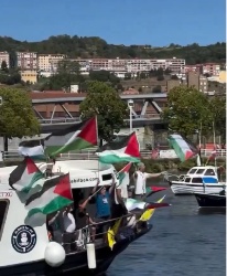 Greenpeace Aotearoa: Israeli Forces Illegally Attack Peaceful Humanitarian Flotilla
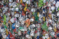 Zero Waste Network: Container Return Scheme Bill Could Save Councils $50m A Year And Put Money Back In Households