 Scoop has an Ethical Paywall


NIWA mapping Clive Hard
12 June 2019
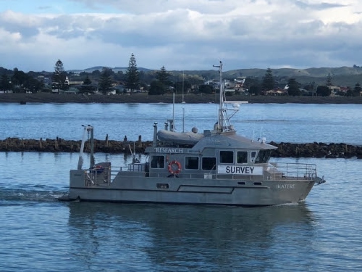
Research catamaran,
Ikatere
The Clive Hard seabed will be mapped this month through a joint project with NIWA and Hawke’s Bay Regional Council.
The NIWA team arrived on their 14m-long research catamaran, Ikatere, on 10 June to learn more about the seabed and marine environment in Clive Hard, the seabed stretching along the coast from Clive to Cape Kidnappers ).
NIWA Project Manager Kevin Mackay says, “We use something called a multi-beam echosounder sonar to map the seabed, and from that we can classify ecosystems and habitats.”
“We create maps that tell us where the sand is, where the rocks are, or where there’s mud. But it’s more than just the mud or the sand – we can tell what’s going on from the shapes we see. Biodiversity loves rough habitat, that’s what they thrive on, so when we find the lumpy bits we know there’ll be lots of biodiversity,” says Mr Mackay.
The monitoring is to help NIWA and the Regional Council identify what areas are important for biodiversity habitat, and to improve ongoing reporting on the state of the marine environment.
“We know the Clive Hard is significant in the coastal marine area because it supports biodiversity, so we want to know more about how healthy it is,” says Anna Madarasz-Smith, Regional Council senior coastal scientist.
Ikatere will be mapping around 30 square kilometres above the Clive Hard until 24 June, and will be visible from the foreshore near Clive.
ENDS
 University of Auckland: Junk Food Designed To Make Us Eat More, Study Finds
 Spark: New Report Sets Out Outcomes-Led Approach To Lift Rural Connectivity Using The Right Mix Of Technologies
 Bill Bennett: Fixed Voice Rules Head For Deregulation
 UN Department of Global Communications: United Nations Proposes New Global Dashboard To Measure Progress Beyond GDP
 Banking Ombudsman Scheme: Fraud Check Delays Well Worth The Inconvenience, Says Banking Ombudsman
 Asia Pacific AML: NZ’s Financial Crime Gap - Beyond The 'Number 8 Wire' Mentality