 Scoop has an Ethical Paywall


World-leading Technology Will Aid Tory Channel Mariners
A groundbreaking visual aid providing real-time guidance for mariners on current and tide conditions in Tory Channel/Kura te Au goes live on Marlborough District Council’s website on Monday.
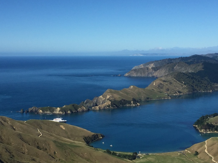
World-leading technology will provide boaties with real-time guidance on the complex tides and currents of Tory Channel/Kura te Au and has potential for applications far beyond a navigational tool
The world-leading technology is the result of more than two years of work as part of Council’s Tide and Current Project, run in conjunction with marine and oceanographic survey experts Oceanum, Calypso Science and iXblue, and was presented to the Environment and Planning Committee today. The model has been made possible due to Council’s investment in the HS51 multibeam survey of Queen Charlotte Sound/Tōtaranui in 2016/17 which captured detailed bathymetric data.
Tory Channel/Kura te Au, the main trunk line for ferries travelling between the North and South islands, has long had a reputation amongst mariners as a complex waterway, Harbourmaster Captain Jake Oliver told the committee.
“Actual currents and expected currents are not always the same which means mariners cannot be certain of the conditions until they have entered the channel. The tide and current model ‘nowcasts’ real-time information on the actual flow conditions at the entrance to the channel and will be free to use,” he said. “There is a high degree of accuracy, and we have confidence in the model. We can project 24 hours ahead and look back at the previous 24 hours as well.”
The Tide and Current Project was funded with $250,000 received from KiwiRail, given to Council as part of an enforceable undertaking imposed on the ferry service following an accident on the Kaiarahi Interislander ferry in April 2019.
Council owns the model, but Oceanum who have developed the product, mathematical models, and visual aids will be able to use the technology developed for other applications around the world. “The technology has the potential to be much more than a navigational safety tool,” Captain Oliver said.
“The only Council investment has been staff time and energy,” he said. Cawthron Institute were also contracted to assist with water flow measurements and data computers on some of the interisland ferries have helped validate the model.
“Without the multibeam data we would not have been able to understand the shape of the Tory channel. Now we will begin looking at the feasibility of expanding the project to encompass the whole of Queen Charlotte Sound/ Tōtaranui,” Captain Oliver said.
Tide and current conditions in Tory Channel/Kura te Au are significant with currents up to seven knots (13 km/h) having been confirmed in full flood conditions. These currents add complexity to the challenge of navigating safely in this narrow and winding channel.
In the past twenty years there have been at least five serious grounding or near grounding incidents at the Tory Channel/Kura te Au entrance involving a large ferry or another type of ship. The most recent ship grounding was the grounding of the Cruise Ship Azamara Quest in January 2016.
The novel new visual aid will also be available in time via the Marlborough Cruise Guide.
 Bill Bennett: Fixed Voice Rules Head For Deregulation
 UN Department of Global Communications: United Nations Proposes New Global Dashboard To Measure Progress Beyond GDP
 Banking Ombudsman Scheme: Fraud Check Delays Well Worth The Inconvenience, Says Banking Ombudsman
 Asia Pacific AML: NZ’s Financial Crime Gap - Beyond The 'Number 8 Wire' Mentality
 Westpac New Zealand: Kiwi Households Adapting Despite Widespread Cost Pressure Concerns, Westpac Survey Shows
 University of Auckland: Kids’ Screen Use Linked To Long-Term Deficits In Self-Control And Attention