High Pressure Dominates But More Large Waves Due Mid-week
Covering period
of Monday 23 - Thursday 26
May
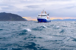
Large southwest swells battered exposed coasts over the weekend, including south facing coasts in Wellington and Wairarapa where 7 metre waves damaged some coastal roads.
MetService is forecasting another period of large south to southwest swell waves to affect southern and eastern coasts of New Zealand on Wednesday and Thursday, which will likely result in further warnings being issued, including for Wellington’s south coast. In addition, the Chatham Islands could once again see waves approaching 10 metres on Wednesday and Thursday, along with a period of southwest gales.
MetService Meteorologist Peter Little explains, “These swell waves are being generated by a large area of southwest gales that is blowing over the Southern Ocean between New Zealand and Antarctica. These large swell waves have the potential to cause coastal inundation and erosion of our shores, especially around high tide. Beach users and boaties are advised to exercise caution as these unusually high swell waves will be hazardous.”
Above the ocean surface, a large slow-moving area of high pressure over the Tasman Sea directs a southwest flow over the country for much of the week. Strong southwest winds about coastal parts of Southland and Otago spread to eastern areas as far north as East Cape for a time on Wednesday or Thursday following the passage of a weak front. Although showers are mostly confined to southern and western regions this week, they are also expected to move into eastern areas for a time as winds turn more southerly following the front.
Little comments, “A weak cold front that is forecast to move northwards over the South Island on Wednesday may provide another dusting of snow down to 600 metres over southern New Zealand, which may affect a few higher roads. With only one week to go until the start of winter it’s unusual that we’re still waiting for the first big snow dump of the year.”
By the end of the working week the high finally spreads over New Zealand, bringing light winds and settled weather to most regions.
“Frosty mornings are going to be the norm in places sheltered from the south to southwest winds, especially inland parts of both islands where temperatures around -3°C are likely around dawn,” adds Little.


 Gordon Campbell: On How US Courts Are Helping Donald Trump Steal The Mid-Terms
 Office of the Ombudsman: Ombudsman Publishes Findings On Ministry Of Education Sensitive Claims Scheme
 Nelson City Council: Mayor Welcomes Auditor-General Decision Not To Prosecute Councillor
 Johnnie Freeland: Ko Tātou Tātou - Climate Action In Aotearoa Begins With Relationship
 Zero Waste Network Aotearoa: Container Return Scheme Bill Would Double Recycling Rates And Put Money Back In Households
 Wellington City Council: Statement From The Wellington Mayoral Forum On Options For Regional Governance Reform
 MUNZ: TAIC Report On Kaitaki Incident Gives Shocking Picture Of Decline Of NZ Maritime Infrastructure


