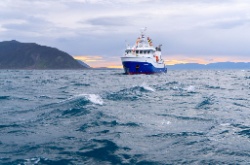
The Storm Before The Calm
Covering period
of Monday 4th - Thursday 7th
March
Today, a strong cold front has passed over the South Island and MetService is forecasting it will make its way north-eastwards over the North Island. The front is accompanied by strong northwesterly winds, heavy rain and a risk of thunderstorms. Winds change to a strong southwesterly tomorrow, bringing showers and lowering temperatures. By the second half of the week, the weather starts to settle, and high pressure dominates over much of the country.
There are several Severe Weather Watches and Warnings associated with the front today. Wind and rain Watches are active for much of the lower and central North Island. Orange Heavy Rain Warnings are in place for the Tararua Range and Mount Taranaki. A Severe Thunderstorm Watch has also been issued for The Marlborough Sounds, western and southern areas of the North Island up to Waikato. As the front progresses northwards there is a chance of a Severe Thunderstorm Warning, a localised Red Warning, being issued in these areas. There is also a risk of Thunderstorms outside the watch area in Auckland, Bay of Plenty and Taupo from this afternoon.
MetService Meteorologist Juliane Bergdolt advises: “The thunderstorms carry the risk of heavy rain and localised downpours, with rainfall rates of 25 – 40 mm/h possible within the watch area. Surface and flash flooding is a risk with these amounts of rain in such a short timeframe. Strong winds with possibly damaging gusts between 90 – 100 km/h can also be expected in the vicinity of a thunderstorm.“
For the South Island, most Warnings and Watches associated with this front have now been lifted. Over the course of this morning, thunderstorms were observed about the Southern Alps and the Marlborough Sounds. Rainfall accumulations reached 67 mm in Milford Sound and up to 86 mm in western parts of the Marlborough Sounds. Gale force northwesterly winds were recorded about the Canterbury High Country with gusts up to 140 km/h in exposed places.
The strong northwesterly winds will generate heavy swells along the western coast on Tuesday morning. Swells of 4 to 6 metres are possible around the West Coast, Kapiti, and Taranaki coastlines.
Behind the front the wind changes to a strong, and cold, southwesterly, strongest about coastal Southland, Clutha and Dunedin where a Severe Wind Watch has been issued for Tuesday until 2pm. Temperatures are set to drop with an influx of cold air from the south. A Road Snowfall Warning has been issued for Crown Range Road, where snow flurries are possible overnight, but are unlikely to settle. In the lower South Island, daytime temperatures are expected to stay in the low teens on Tuesday, with Invercargill’s maximum at 11°C. “The combination of cool temperatures and strong winds can also lead to wind chill, making the perceived temperature even lower.” says Bergdolt.
On Wednesday the weather starts to settle with a ridge of high pressure moving in over the country, leading to the return of calmer weather for the second half of the week.
Please keep up to date with the most current information from MetService at www.metservice.com


 Gordon Campbell: On How US Courts Are Helping Donald Trump Steal The Mid-Terms
 Office of the Ombudsman: Ombudsman Publishes Findings On Ministry Of Education Sensitive Claims Scheme
 Nelson City Council: Mayor Welcomes Auditor-General Decision Not To Prosecute Councillor
 Johnnie Freeland: Ko Tātou Tātou - Climate Action In Aotearoa Begins With Relationship
 Zero Waste Network Aotearoa: Container Return Scheme Bill Would Double Recycling Rates And Put Money Back In Households
 Wellington City Council: Statement From The Wellington Mayoral Forum On Options For Regional Governance Reform
 MUNZ: TAIC Report On Kaitaki Incident Gives Shocking Picture Of Decline Of NZ Maritime Infrastructure


